Defining Local Climate Zone (Urban and Rural Domain) for Richmond, VA using ArcGIS
Course: GIS Algorithms and Programming
George Mason University
Geospatial Workflows to analyze Urban Heat Island
Problem Introduction:
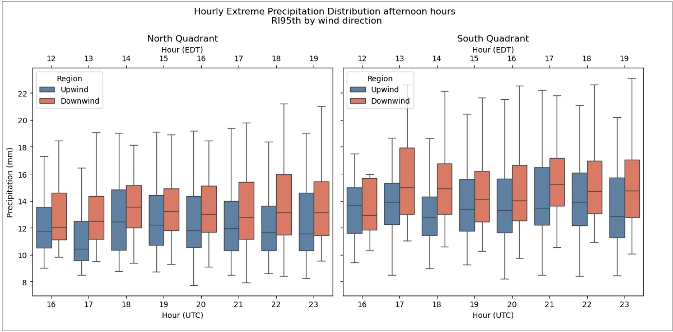
Cities alter local climate through urban heat and rainfall anomalies. To study this effect, I needed a reliable way to distinguish urban cores from surrounding suburban and rural areas.
Solution:
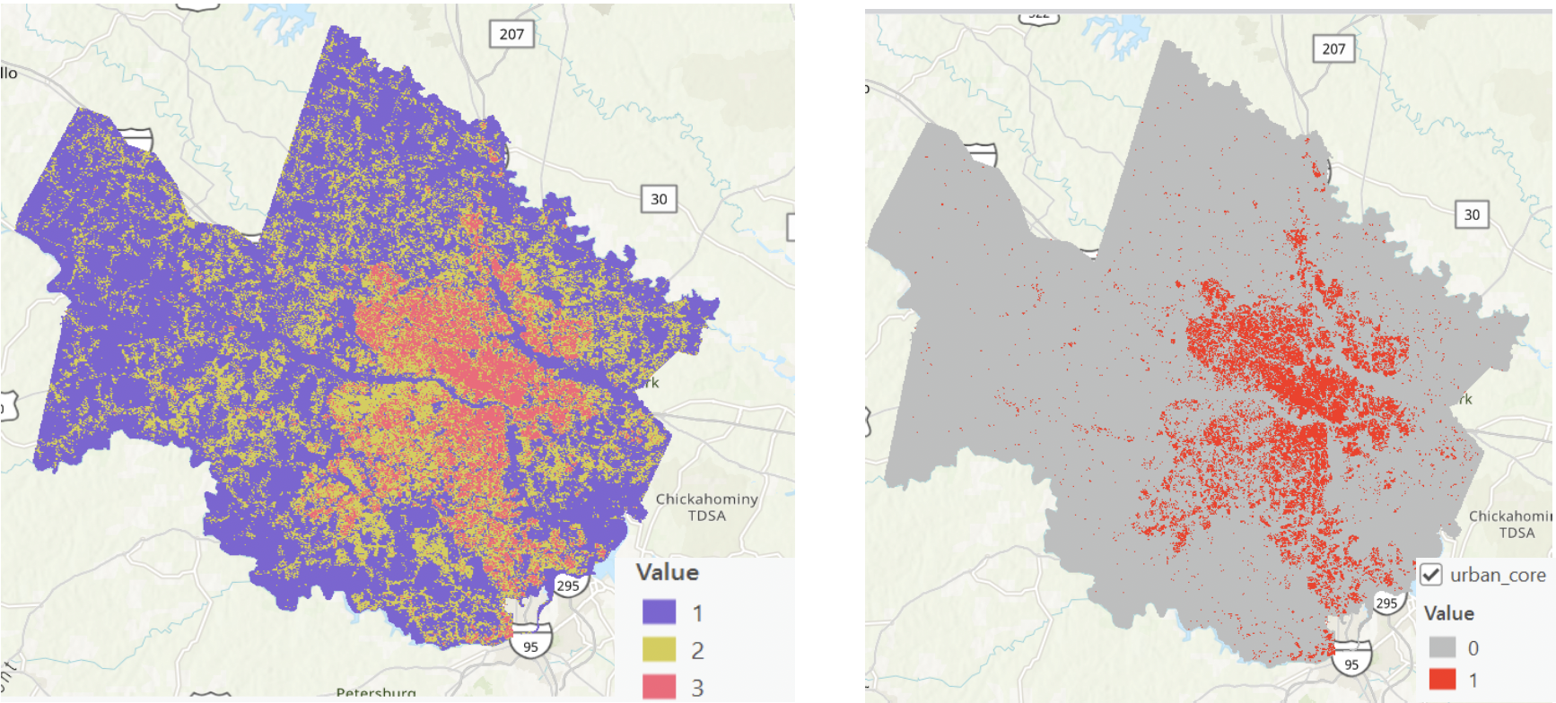
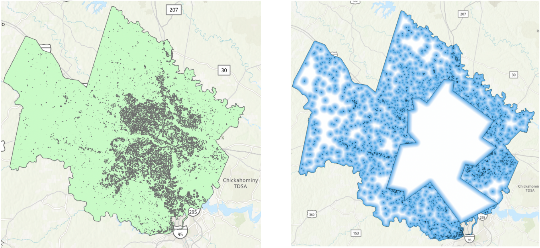
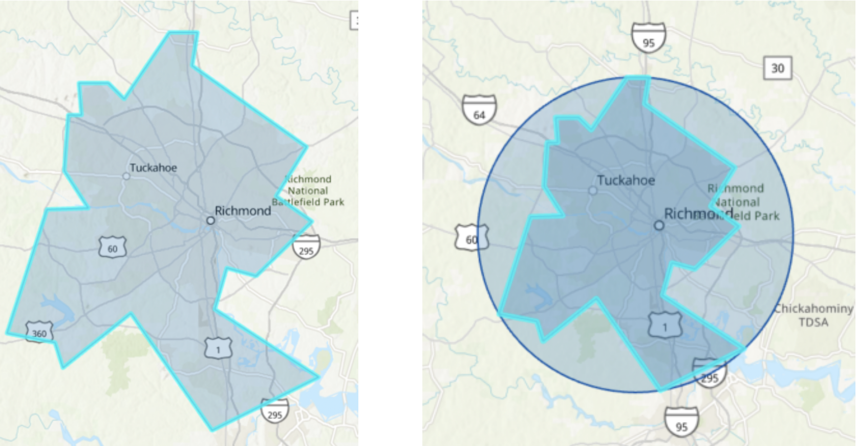
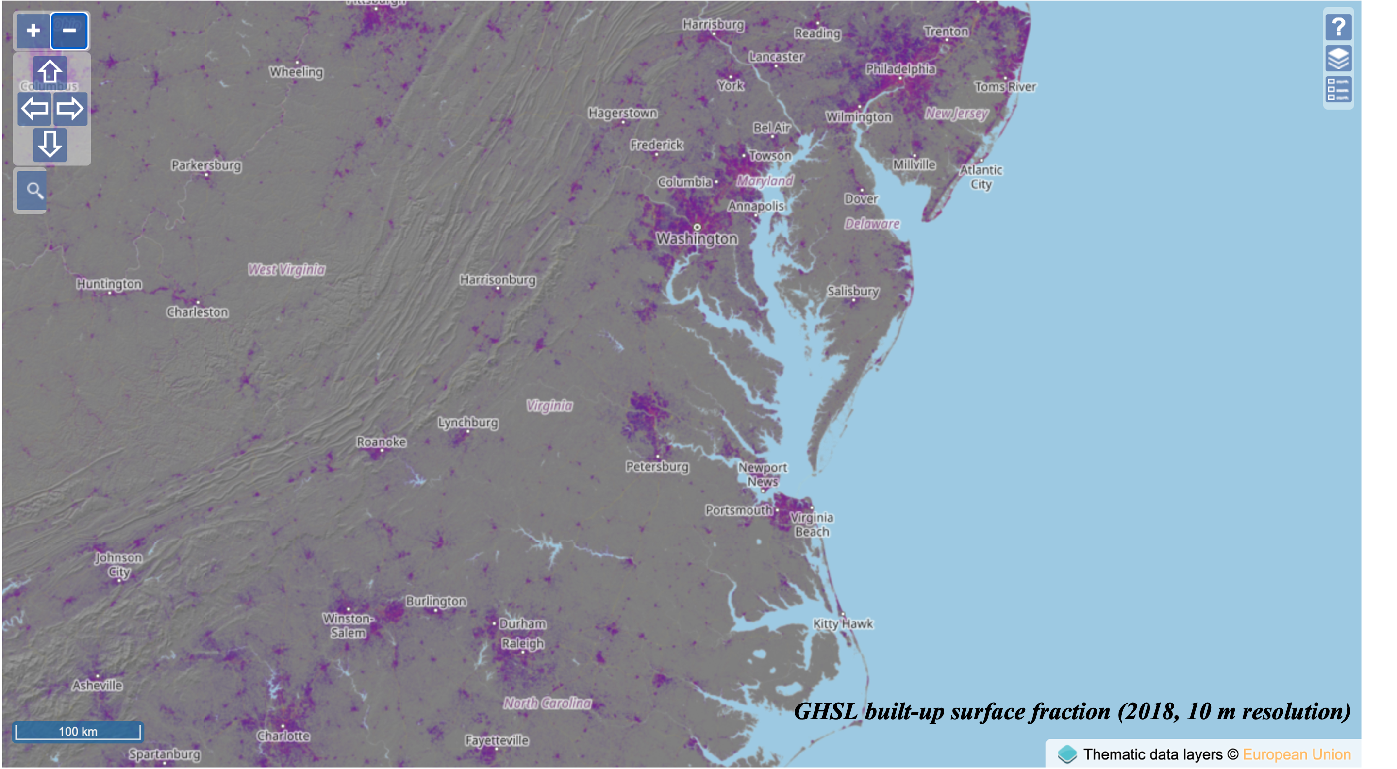
Defined Local Climate Zones (LCZs) for Richmond, VA, by delineating an urban core and generating concentric suburban (R1) and rural (R2) buffers using ArcGIS Pro and Python (arcpy)
📊 Data Sources
-
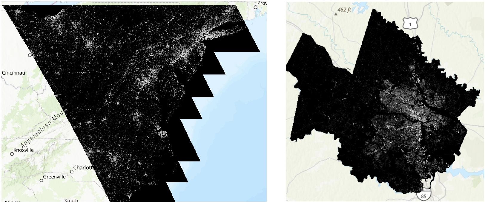
Global Human Settlement Layer (GHSL)
100m resolution built-up surface raster (2023) -
Greater Richmond shapefile
Administrative boundary data
🛠️ Tools & Techniques
-
ArcGIS Pro
GUI + arcpy scripting -
Spatial Analysis
Raster reclassification, raster-to-polygon conversion, buffer analysis